
Experts predict that an extraordinary “Godzilla El Niño” event could occur this year. Meteorologists and climate scientists use this unofficial term to describe an exceptionally powerful El Niño. The reference to Godzilla is not about the movie monster; it’s a metaphor for the event’s destructive potential.
With La Niña finally weakening, scientists are watching the Pacific closely. New models from the European Centre for Medium-Range Weather Forecasts (ECMWF) show that sea surface temperatures in the tropical Pacific are likely to rise sharply over the next six months. Because of that, experts do not rule out the possibility of a super-El Niño developing.
What is a “Godzilla” El Niño?
El Niño is a natural climate cycle driven by fluctuations in sea surface temperature and atmospheric pressure in the eastern tropical Pacific. Its effects extend well beyond that region, influencing global temperatures, rainfall patterns, droughts, tropical cyclone activity, heat waves, and other weather extremes.
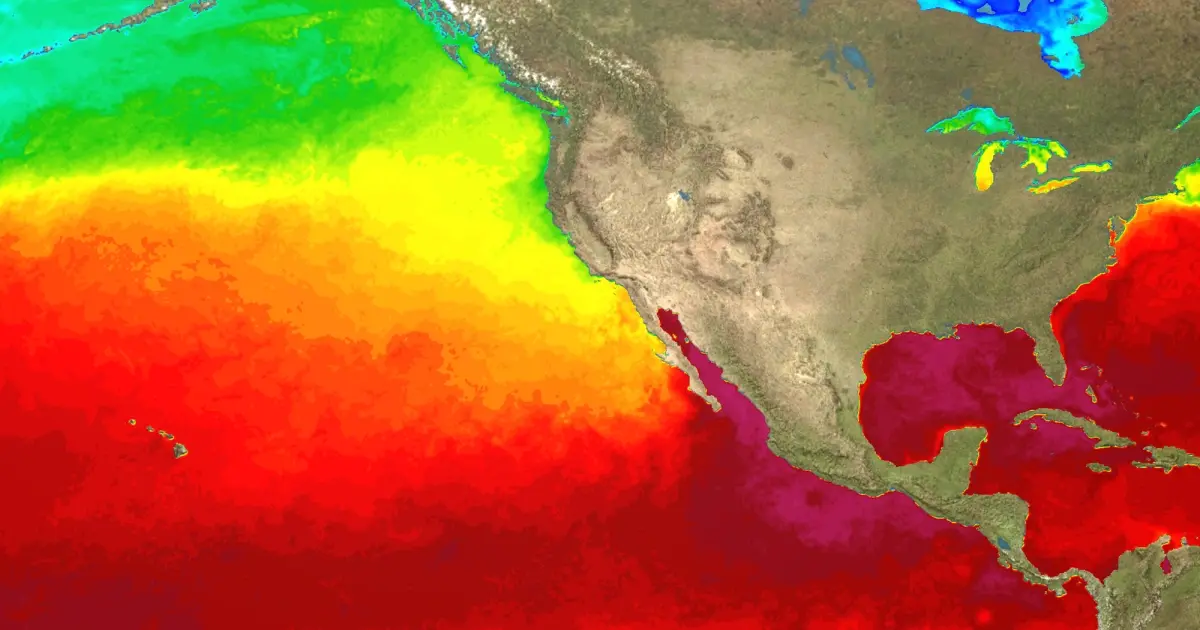
During El Niño years, average global temperatures rise noticeably. Weather patterns shift dramatically: the southern United States and parts of Europe tend to get heavier rainfall and face higher flood risk, while northern regions of North America often become drier and warmer than usual. El Niño also suppresses the Atlantic hurricane season. In contrast, tropical cyclone activity tends to increase in the central and eastern Pacific, IFLScience reported.
What would a weather monster actually do?
We are moving out of La Niña and toward El Niño, and this transition could produce a very strong event that some are calling a “Godzilla” El Niño.
The last comparable event occurred in 2015–2016. In the eastern Pacific, sea surface temperatures reached extremely high levels and triggered a series of environmental disasters around the world.
Major meteorological organizations — the U.S. National Oceanic and Atmospheric Administration (NOAA), the World Meteorological Organization (WMO), and the Australian Bureau of Meteorology — have not yet declared whether this coming event will be record-breaking, although they have signaled that possibility.
“Over the coming months, the WMO will monitor the situation closely to support informed decision-making. The last El Niño event in 2023–2024 was one of the five strongest on record and drove record-high global temperatures in 2024,” WMO Secretary-General Celeste Saulo said.
“Seasonal forecasts for El Niño and La Niña help avoid multi-million-dollar economic losses and serve as critical planning tools for climate-sensitive sectors such as agriculture, health care, energy, and water management,” she added.
So, while calling the event “Godzilla” may be premature, conditions in the Pacific are clearly intensifying. Expect updated forecasts in the coming weeks and months.
Photo: www.pixabay.com